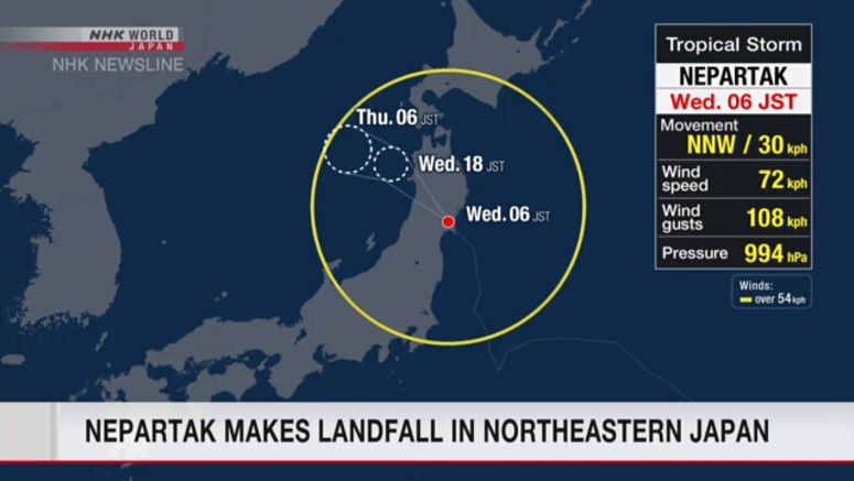
Nepartak Makes Landfall In Miyagi Prefecture

Tropical storm Nepartak made landfall on the Pacific coast of northeastern Japan on Wednesday morning.
The Meteorological Agency says Nepartak landed around Ishinomaki City in Miyagi Prefecture at 6 a.m. on Wednesday.
Nepartak has an atmospheric pressure of 994 hectopascals at its center. It is packing winds of up to 72 kilometers per hour and maximum gusts of 108 kilometers per hour.
Winds of more than 54 kilometers per hour are blowing within 500 kilometers north and 390 kilometers south of the center.
Radar analysis shows that about 33 millimeters of rain fell in Rikuzentakata City, Iwate Prefecture, in the hour up to 8 a.m. on Wednesday.
Weather officials issued a mudslide advisory for some areas of Iwate and Miyagi prefectures.
In Hachinohe City, Aomori Prefecture, maximum winds of nearly 60 kilometers per hour were observed at around 7: 40 a.m. on Wednesday.
Nepartak is likely to cause downpours accompanied by thunder in the Tohoku and Kanto-Koshin regions.
For the 24 hours through Thursday morning, weather officials forecast up to 100 millimeters of rain in the Tohoku region.
Winds of up to 72 kilometers per hour and maximum gusts of 108 kilometers per hour are forecast for the Pacific coast side of the Tohoku area.
Officials are warning of mudslides, floods in low-lying areas, swollen rivers, gusts, high waves.