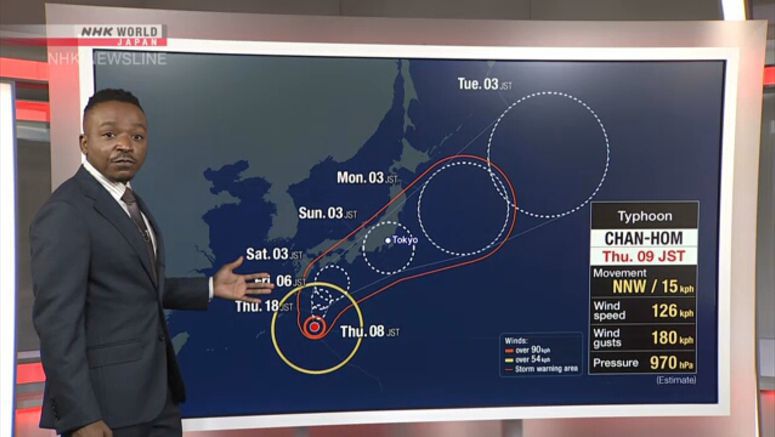
Typhoon Chan - Hom Could Bring Heavy Rain

Weather officials in Japan say Typhoon Chan-hom may approach southwestern Japanese islands on Thursday. They are advising people to keep an eye on weather reports and stay on the alert for heavy rain, stormy winds and high waves.
The Meteorological Agency says Chan-hom was over waters 240 kilometers east-northeast of the island of Minami Daitojima at midnight between Wednesday and Thursday, and moving northwest at about 25 kilometers per hour.
The typhoon had a central atmospheric pressure of 970 hectopascals. It was packing maximum winds of 126 kilometers per hour near its center.
The agency predicts the storm may approach the Daitojima region of Okinawa Prefecture around dawn on Thursday. It may come close to the Amami region of Kagoshima Prefecture and western Japan on Friday.
The storm could approach eastern Japan on Saturday and may make landfall.
Officials are forecasting strong winds and high waves.
The agency is also calling for caution against heavy rain even in areas far from the typhoon because the rain front in the south of Japan will become active.


