Chanthu Expected To Make Landfall In Western Japan

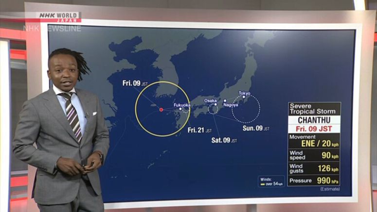
Weather officials say severe tropical storm Chanthu is expected to make landfall in the area of western Japan that includes northern Kyushu on Friday afternoon or later.
Localized downpours are already hitting the Kyushu region. Torrential rain is also falling in Kochi Prefecture in the Shikoku region.
The Meteorological Agency says that as of 7 a.m. on Friday, the storm was about 180 kilometers west of the city of Goto in Nagasaki Prefecture, and was moving northeast at a speed of 15 kilometers per hour.
It has a central atmospheric pressure of 990 hectopascals, and central winds of 90 kilometers per hour, with gusts up to 126 kilometers per hour.
Chanthu was initially expected to become a low pressure system near the Tsushima Strait, but has now gathered greater strength than expected.
In the hour through 6 a.m. on Friday, 83 millimeters of torrential rain were recorded in the city of Tosashimizu in Kochi Prefecture.
Miyazaki Prefecture had more than 500 millimeters of rain in the past 72 hours. Landslide alerts have been issued for parts of the prefecture.
In the 24 hours through Saturday morning, up to 300 millimeters of rain are forecast for Shikoku, 250 millimeters for northern Kyushu and Tokai, 200 millimeters for Chugoku and Kinki, 150 millimeters for southern Kyushu, 120 millimeters for Kanto-Koshin and Hokuriku and 100 millimeters for Tohoku.
The rain will spread to eastern and northern Japan, and in the 24 hours through Sunday morning, 200 to 300 millimeters of rain are expected in Tokai, 100 to 200 millimeters in Kanto-Koshin, 100 to 150 millimeters in Kinki and Tohoku and 50 to 100 millimeters in Hokuriku.
Winds of up to 90 kilometers per hour are expected on Friday in northern Kyushu, 83 kilometers in Chugoku, Shukoku and Kinki, 72 kilometers in southern Kyushu, Tokai and Kanto-Koshin and 65 kilometers in Tohoku.
Weather officials are warning of landslides, flooding in low-lying areas, swollen rivers, violent winds, high waves and storm surges. Lightning strikes, tornadoes and other gusty winds are also possible.