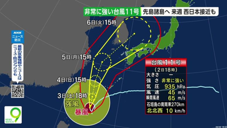
Typhoon Hinnamnor Approaching Okinawa's Southwestern Islands

Typhoon Hinnamnor is over waters south of Okinawa Prefecture, and is forecast to approach its southwestern islands between Saturday evening and early Sunday.
The Meteorological Agency says the powerful typhoon was traveling northwest at a speed of 10 kilometers an hour Friday afternoon over waters south-southeast of Ishigaki Island. It was almost stationary through that morning.
Agency officials say the typhoon will again develop and be very close to the prefecture's southwestern islands.
Very strong winds are expected in some areas as early as Saturday morning. The agency forecasts violent winds that could destroy some houses from Saturday evening on those islands.
Officials predict winds up to 180 kilometers per hour, gusts up to 252 kilometers per hour and waves as high as 10 meters.
In some parts of Okinawa Prefecture, up to 150 millimeters of rain is expected in a 24-hour period through Saturday evening, and 200 to 300 millimeters for the next 24 hours through Sunday evening.
Weather officials say Hinnamnor may approach Kyushu and other areas of western Japan around the middle of next week.