Typhoon Hinnamnor On Course For Japan's Southwestern Islands

Japanese weather officials are warning that Typhoon Hinnamnor could bring extremely strong winds to Japan's southwestern islands on Wednesday.
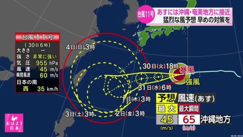
The Meteorological Agency says that as of 3 a.m. on Tuesday, the very strong typhoon was located south of the Japanese archipelago and moving westward at a speed of 35 kilometers per hour.
The agency says the storm had a central atmospheric pressure of 955 hectopascals.
The storm was packing winds of 162 kilometers per hour near its center and gusts of 216 kilometers per hour. Winds of at least 90 kilometers per hour were blowing within a 110-kilometer radius of its center.
The typhoon is expected to approach Okinawa and the Amami region in Kagoshima Prefecture on Wednesday while maintaining its strength. Houses on Okinawa's Daitojima islands could be toppled by ferocious winds.
The typhoon will also likely bring the Okinawa region winds of up to 162 kilometers per hour, and gusts of up to 234 kilometers per hour. Extremely rough seas are expected with waves reaching 9 meters in the Okinawa region and 6 meters in the Amami region.
It is also expected to bring torrential rain mainly to the Daitojima islands. In the 24 hours through Thursday morning, up to 300 millimeters of rain may fall.
Officials are warning of strong winds and high waves.