Typhoon Chan - Hom Heading For Western Japan

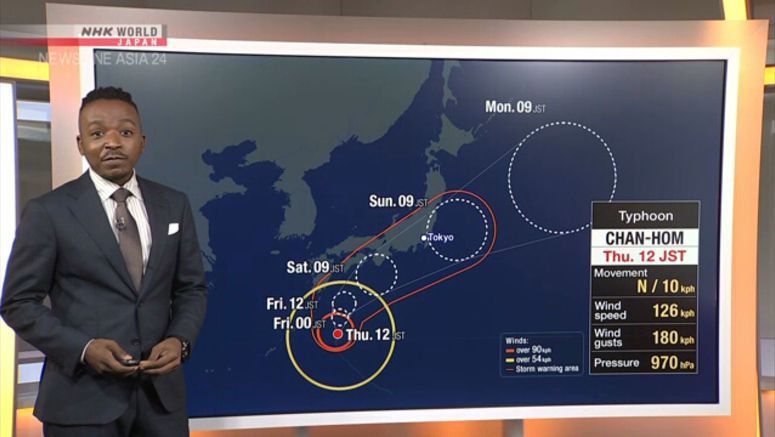
Typhoon Chan-hom is expected to approach western and eastern Japan in the next couple of days. Weather officials warn that the typhoon will bring heavy rain even before its actual approach.
The Meteorological Agency says that at noon on Thursday, Chan-hom was 320 kilometers southeast of Tanegashima Island in Kagoshima Prefecture, southwestern Japan, and was moving north at about 15 kilometers per hour.
The typhoon had a central atmospheric pressure of 970 hectopascals. It was packing maximum winds of 126 kilometers per hour near its center.
The agency says the typhoon will continue moving north while it develops and could approach western Japan as early as Friday and eastern Japan on Saturday or later.
Officials also forecast strong winds and high waves.
The agency is calling for caution against heavy rain even in areas far from the typhoon because a rain front to the south of Japan will become active as the typhoon heads north.
Agency officials are urging people to stay updated on the typhoon and to take early precautions for violent winds and high waves, as well as for landslides, flooding of low-lying areas and rising rivers.


