Typhoon Haishen Approaching Southwestern Japan

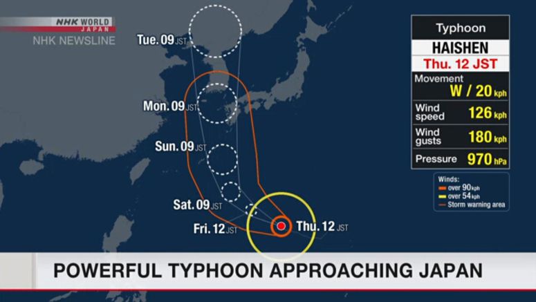
Typhoon Haishen is gathering strength over waters south of Japan. The powerful storm is expected to approach the southwestern part of the country between Sunday and Monday.
Japan's Meteorological Agency said the typhoon was moving westward at a speed of about 20 kilometers per hour as of noon Thursday, Japan time.
The storm's central atmospheric pressure was 970 hectopascals and its core maximum wind velocity was 126 kilometers per hour with a maximum instantaneous wind speed of up to 180 kilometers.
The typhoon is expected to turn northward and approach the Daitojima region of Okinawa Prefecture.
Gale-force winds of up to 180 kilometers per hour are forecast for Okinawa and the Amami region of Kagoshima on Saturday.
The storm's central atmospheric pressure is expected to drop to 915 hectopascals as of 9:00 a.m. Sunday. Its core maximum wind speed is seen at 198 kilometers with gusts of up to 288 kilometers per hour.
Agency officials say the storm could bring heavy rain, violent winds, high waves and storm surges, and that emergency warnings are possible.
They're warning that devastating damage could occur over a wide area even if the typhoon does not make landfall on Kyushu, citing its wide storm zone and tremendous strength.
Officials are urging people in areas that could be affected to be ready, by assessing risks around their homes and preparing for evacuation.


